- Total News Sources
- 1
- Left
- 0
- Center
- 0
- Right
- 0
- Unrated
- 1
- Last Updated
- 2 days ago
- Bias Distribution
- 100% Unrated
Scattered Thunderstorms Impact North Dakota, Warm Conditions Persist Midwest
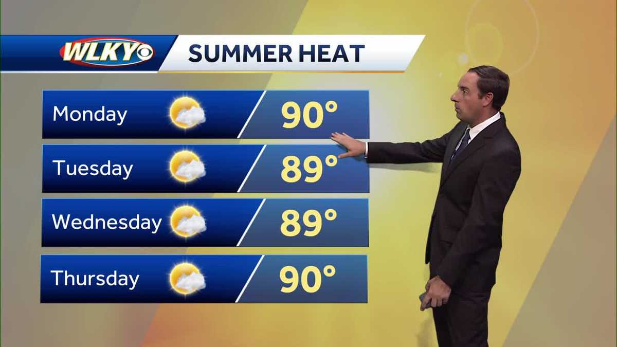
As the final week of astronomical summer begins, much of the United States is experiencing warm and mostly dry conditions with temperatures ranging from the upper 70s to mid-90s, depending on the region. Eastern North Dakota and parts of the northern Plains saw thunderstorms and isolated severe weather, including tornado reports, with rain totals around a half inch, while other areas like Wisconsin and Texas are enjoying mostly sunny skies and summer-like warmth. A weak frontal boundary is expected to bring scattered showers and cooler temperatures to some regions by midweek, with highs dropping closer to average for mid-September. Despite these passing disturbances, many areas will remain warm and dry through midweek, with highs often near or above 85 to 90 degrees, well above seasonal norms. Looking toward the end of the week, a low-pressure system will bring chances of showers and thunderstorms, along with more fall-like temperatures in the 70s, but no severe weather is currently expected. Overall, residents should prepare for a mix of summer warmth and intermittent rain as the season transitions toward fall.
- Total News Sources
- 1
- Left
- 0
- Center
- 0
- Right
- 0
- Unrated
- 1
- Last Updated
- 2 days ago
- Bias Distribution
- 100% Unrated
Stay in the know
Get the latest news, exclusive insights, and curated content delivered straight to your inbox.

Gift Subscriptions
The perfect gift for understanding
news from all angles.