- Total News Sources
- 1
- Left
- 0
- Center
- 1
- Right
- 0
- Unrated
- 0
- Last Updated
- 196 days ago
- Bias Distribution
- 100% Center
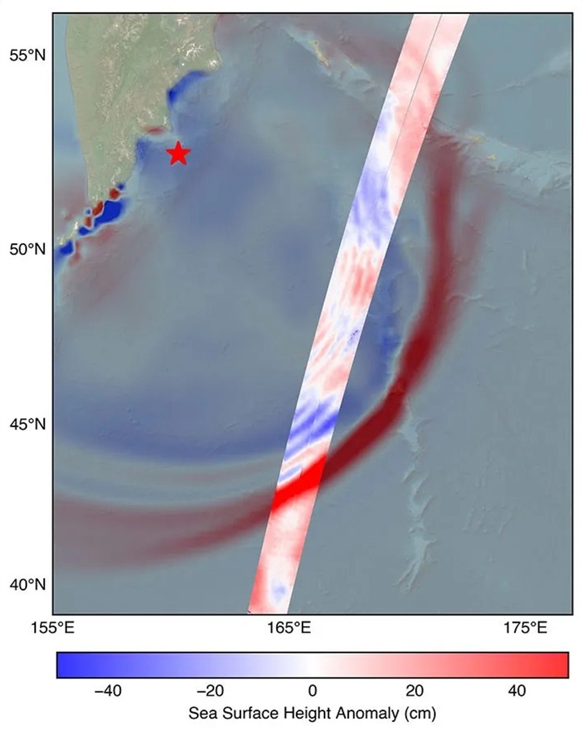
US-French SWOT Satellite Measures Kamchatka Tsunami Post-8.8 Quake
The U.S.-French SWOT (Surface Water and Ocean Topography) satellite, a collaborative mission involving NASA, CNES, the Canadian Space Agency, and the UK Space Agency, captured detailed data of the tsunami triggered by an 8.8 magnitude earthquake off Russia's Kamchatka Peninsula on July 30, 2025. About 70 minutes after the quake, SWOT measured the leading edge of the tsunami wave at approximately 45 centimeters high in the open ocean, which can amplify significantly near coastal areas. This satellite data, including wave height, shape, and travel direction, was compared against NOAA's tsunami forecast model, validating the model's accuracy and enhancing future predictive capabilities. Scientists emphasize that SWOT's broad ocean coverage provides critical real-world validation, unlocking new physics and improving early warning systems for safer coastal communities. The integration of SWOT data into operational forecasting marks a significant advancement since the 2004 Sumatra tsunami disaster, potentially enabling more effective evacuation plans and disaster preparedness. Continued investment in satellite technology and research is essential to further improve tsunami forecasting and mitigate risks to vulnerable populations.

- Total News Sources
- 1
- Left
- 0
- Center
- 1
- Right
- 0
- Unrated
- 0
- Last Updated
- 196 days ago
- Bias Distribution
- 100% Center

Related Topics
Stay in the know
Get the latest news, exclusive insights, and curated content delivered straight to your inbox.

Gift Subscriptions
The perfect gift for understanding
news from all angles.