Negative
21Serious
Neutral
Optimistic
Positive
- Total News Sources
- 1
- Left
- 0
- Center
- 0
- Right
- 1
- Unrated
- 0
- Last Updated
- 106 days ago
- Bias Distribution
- 100% Right
Chilcotin River Landslide Triggers Evacuations and Closures
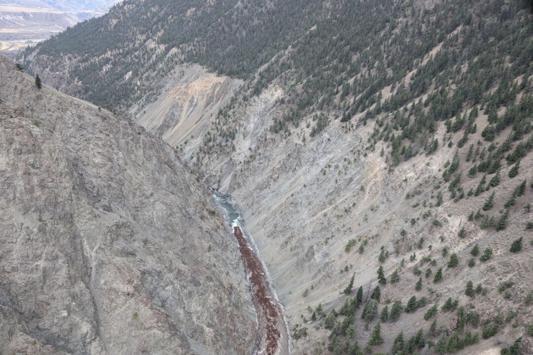
A significant surge of water from a breached landslide at the Chilcotin River is moving towards British Columbia's Lower Mainland, prompting the closure of public areas in Maple Ridge and New Westminster as a precaution. The landslide, which occurred at Farwell Canyon, created an 11-kilometer long lake behind a natural dam, which began overflowing on August 5. Emergency Management Minister Bowinn Ma has warned that the fast-flowing waters could raise river levels by about a meter at Hope, B.C., and carry potentially dangerous debris downstream. Satellite imagery has captured the extent of the landslide and subsequent flooding, aiding authorities in their response. Indigenous leaders have expressed concerns about the impact on the forthcoming salmon run. Evacuation orders have been issued for areas along the Chilcotin and Fraser rivers due to the flooding risks.

- Total News Sources
- 1
- Left
- 0
- Center
- 0
- Right
- 1
- Unrated
- 0
- Last Updated
- 106 days ago
- Bias Distribution
- 100% Right
Negative
21Serious
Neutral
Optimistic
Positive
Stay in the know
Get the latest news, exclusive insights, and curated content delivered straight to your inbox.