Negative
25Serious
Neutral
Optimistic
Positive
- Total News Sources
- 4
- Left
- 2
- Center
- 0
- Right
- 1
- Unrated
- 1
- Last Updated
- 1 hour ago
- Bias Distribution
- 67% Left
Southern California Fire Hazard Maps Updated
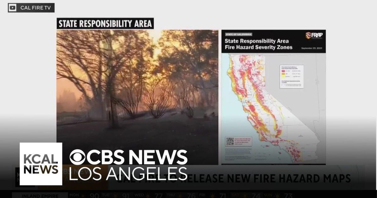
Cal Fire has released updated Fire Hazard Severity Zone maps for Southern California, marking the first comprehensive update in nearly 15 years. These maps indicate a significant expansion in high-risk fire areas, with Southern California seeing a 26% increase in 'very high' fire hazard zones since 2011. Particularly affected areas include Los Angeles and San Diego counties, where the new maps highlight an urgent need for improved wildfire mitigation strategies. The maps categorize zones into 'moderate,' 'high,' and 'very high' risk levels, affecting land-use decisions and building codes. These updates come after devastating wildfires and amidst growing concerns over climate change's impact on fire behavior. State Fire Marshal Daniel Berlant emphasized the maps' role in informing residents and local governments about necessary preparations to enhance community resilience against future wildfires.


- Total News Sources
- 4
- Left
- 2
- Center
- 0
- Right
- 1
- Unrated
- 1
- Last Updated
- 1 hour ago
- Bias Distribution
- 67% Left
Negative
25Serious
Neutral
Optimistic
Positive
Related Topics
Stay in the know
Get the latest news, exclusive insights, and curated content delivered straight to your inbox.

Gift Subscriptions
The perfect gift for understanding
news from all angles.